SALUS - The Crisis Hub
![]()
HSAC's Crisis and Event Management Platform
What is GIS?
Geographic Information Systems, commonly known as GIS, is a mapping technology used to manage and analyze data. GIS is used to visualize information, such as patterns and relationships, that help crisis managers make informed decisions and gain a more complete situational awareness before, during and after a crisis.
Use SALUS to enhance readiness and resilience for your organization and the community you serve.
- Analyze location-driven trends to ensure resources are aligned with objectives
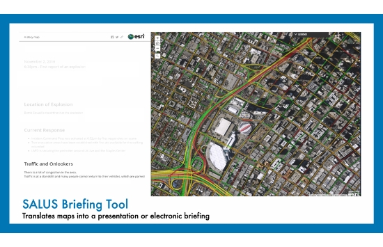
- Create electronic briefings using dynamic maps and data
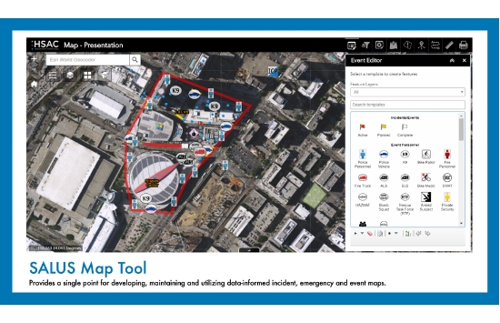
- Develop and map incident, emergency, and event plans
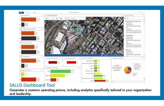
- Generate a common operating picture, including analytics specifically tailored to your organization and leadership
- Identify potentially impacted populations and nearby resources
- See up-to-the-minute incident and event alerts provided by NC4
- Share information from the field to the Command Post, the Emergency Operations Center and organization leadership
- Quickly define threats and hazards and locate critical infrastructure
- Utilize customized, mobile reports that are automatically mapped and analyzed
- Visually represent real-time locations of staff and resources
SALUS Mapping Tool
SALUS Briefing Tool
SALUS Dashboard Tool
SALUS Mobile Platform
